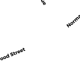
37 NORMAN TODD RD
Owner Information
BEMIS DAVID G
9 GROVE STREET
CAMDEN, ME 04843


Property Details
37 NORMAN TODD RD is classified as a Single Family Residential (Bungalow).
The primary structure on this property was built in 1954. There are 1,146ft2 of built area within this property. There is 1,146ft2 of residential/living space within this property. This property is listed as having 6 rooms.
37 NORMAN TODD RD is valued at $302,200. The land is valued at $181,300 and the structures are valued at $120,900.
This property is in Zone RB. Confirm with local Zoning Board authorities to ensure there are no overlays or other easements on this property.
The most recent deed for 37 NORMAN TODD RD is recorded at the local registrar in Book 30947, Page 454. 37 NORMAN TODD RD was last sold on Wednesday, January 23, 2013 for $1.
Assessment data from fiscal year 2022.
Flood Data
According to the FEMA National Flood Hazard Layer, this property does not appear to be in a flood zone. It may also be in an area not yet reviewed. Nonetheless, confirm this information prior to taking any action.
To view the flood hazards around this property, create a FEMA "Firmette" Map of the area around 37 NORMAN TODD RD.
Broadband Internet Providers
| Provider | Type | Bandwidth (mbps) | |
|---|---|---|---|
| HughesNet | Satellite | 25 | 3 |
| Verizon New England Inc. | DSL | 5 | 0 |
| Viasat Inc | Satellite | 100 | 3 |
| GCI Communication Corp. | Satellite | 0 | 0 |
| Comcast | Cable | 1000 | 35 |
| Verizon New England Inc. | Fiber | 940 | 880 |
| VSAT Systems, LLC. | Satellite | 2 | 1 |
Broadband service provider data from December 2020.
Adjacent Properties
- 114 BEECHWOOD ST
Single Family Residential owned by MCCANN JOHN & HEATHER TRS 1/2 JOHN MCCANN LIVING - 35 NORMAN TODD RD
Single Family Residential owned by BARGENDE ALEXANDER J & EMMA E - 106 BEECHWOOD ST
Single Family Residential owned by REYES RAFAEL R & GERALDINE P - 110 BEECHWOOD ST
Single Family Residential owned by WEBER MELISSA E